Avians Along the Ditch.

24.4 Tuesday.
El Cuervo de la Sevilla to Las Cabezas de Dan Juan.
Anne and Ray become taxigrinos for the day. Readers of previous accounts may remember this is a term (sometimes derogatory) for those peregrinos using local taxis to transport luggage or persons to the next place “en camino” without the walking. Annes boots were not kind to her yesterday.
We start start earlier as it was hot yesterday by our finish time and the three
of us are walking as it starts to get light at seven. We find a side road shortly after reaching Lebrija and our morning coffee this leads eventually to our “ditch” a large irrigation canal flowing from the Rio Guadalquivir just south of Seville to water these flat lands for miles on its east side. It is a magnet for birds of all sorts. We see black winged stilts, avocets and pratincoles again, a pair of harriers probably Montagues or Hen harriers and a host of warblers including one with very loud harsh call probably a Grasshopper warbler of some type plus the usual grey wagtails and goldfinches. Betsy finds a snake recently run over on the dirt track at the side of the canal probably a Horseshoe Whipsnake. We leave the canal which is flowing quite strongly into the fields and strike towards Las Cabezas across dirt tracks where our route is indicated by the yellow arrows on rocks and finally enter the town via the local tip.
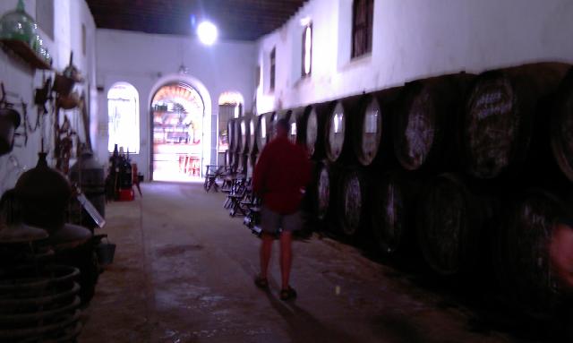
We strike uphill to the obvious church at the top of town seen from a distance where we have agreed to meet Ray and Anne they are there Anne has bought a pair of sandals that seem more comfortable than her boots. We go to the bar at the back of the church where we hear they do rooms. The beer is very welcome but it is the wrong church! Down the hill again to the parish church of San Roc (he of the bad leg, he must be patron saint of taxigrinos). We find the bar and are shown palatial apartments opposite, there is even a washing machine and cooking facilities worth the 20euros pppn.
29km seven and a half hours.

Link to where we are on Google Maps

Jerez to El Cuervo de Sevilla. 23.4 Monday.

We start from the pension at 8oclock but stop down the road at an open cafe we many regulars for coffee and tostados.
We know today we follow the Amigos yellow arrows but also that lunch is likely at a motorway services with several km of motoway on each side.
First we have to find the motorway, suggestions by some to follow the planes (it is near the airport) are treated with contempt. But somehow we miss an arrow and wander arround an industrial estate with a divergence of map from reality occurring. Another cafe is open we have more coffee and ask where the road is that we have a name for from the downloaded Amigos intructions. A puzzeled local points about 40m down the road on the other side. All is now clear we pick up the arrows again and are soon trundleing along a dirt track about 50m from the motorway we are screened by trees from it and the km fly by! (Well it was alot better than it might have been.)
We stop at the services (entered by the loose bit of fence at the back and have a beer and bocadillo each. There are also available large packs of moustaces (we have various suggestions as to what these are) but on reading ingredients on the back we think some form of biscuit, a speciallity of a town we may pass later.
When we leave, out the back there is a small pool and Tim spots pratinicoles, birds previously seen in Portugal on the last Camino.
Passing on we go under the motorway pausing briefly in welcome shade and pass up the side of a sizeable vinyard devoted we think to sherry production.
And thence into En Cuervo and landfall at Hostall Santa Anna which looks good so far, more than can be said for Anne’s feet which are giving problems.
However a day up the motorway that could have been much worse.
27km about seven and a half hours.

Link to where we are on Google Maps

ray 22/04/2012

Experimenting with technology!
A glass of tio pepe in jerez is the reward for our first day on the camino surrounded by crumbling over decorated churchs and handsome mansions. no vines. but large bodegas, all closed cos its sunday, domecq,harveys bristol cream,the walk was good too.

The old salt pans out.

22.4 Sunday Domingo.
Our augmented party of five are fed (magdelanas and orange juice) and readyfor off at 0800hrs. We set off briskly down the street from our lodging in Puerto Royal to the University of Cadiz site just over the main route and railway. From here our route has been marked by the amigos de Cadiz with the conventional yellow arrows and while not as prolifically signed as on other routes it is perfectly adequate. We stroll through the Park Natural of the salt pans and marsh. For the first kilometer or so plants are labelled with photos and Spanish and Latin names quite educational (well it is a university). Further on we see more smaller waders such as Ringed Plover and a Curlew and have coffee in a visitor centre for the saltpans with a couple of nice modern steel sculptures of sea birds and proceed up the main road at the edge of El Puerto de Santa Maria. Readers may remember the names of the three ships that “sailed the ocean blue in 1492” with Colombus from this port. Santa Maria, La Nina, and La Pinta. Halfway round the main road we meet La Nina stranded on a roundabout. We can well understand why the old salt Columbus was faced with mutiny some weeks out as it is tiny (if indeed a reasonable replica).
We pass eventally into open country and then again along the old road aside the main road into Jerez following the yellow arrows till we collapse in a nearly closed bar (it is Sunday afternoon) for a well earned beer. We find lodgings in the pension of the Hotel Sanvi clean and ok, and go out immediately for lunch at 1500. This included Cuban rice (with fried egg and fresh tomato sauce) and Gallo Fritas (which should have been fried cockerel) but in fact was deliciously marinaded fish bits fried in batter.
A wander round the various churchs and the castle (much very old carved stonework) completed our afternoon, unfortunately as predicted on a Sunday all the Bodegas are shut.

A wade around the saltmarsh.

21.4.12 Saturday.
Today we are due to meet Ray and Anne, who have just flown out from England, in Puerto Real a bit further round the bay of Cadiz. The bay consists of a mix of salt marsh and Atlantic Ocean with the spit of land leading to Cadiz along the south of the bay and the saltmarsh with its salinas (salt pans) to the west. We set off northish out of town and into fields and soon come across the only remaining part of the 60km aqueduct that carried water to Gades in Roman times.
A little later after minor route dificulties we see at the top of a slight rise two men apparently fishing, as we get closer it becomes apparent that they have no rods and later no water! We then notice the small birds in cages on the top of poles arranged in a wide circle around each man. The birds sing loudly, and we have no idea what was going on!
Soon after we reach the edge of the salt marsh and walk round the edge spotting waders. As well as the previously spotted blackwinged stilts we see avocets and a pair of redshanks, the avocets were also spotted by Ray and Anne from the train on the way to Cadiz.
Due to the marvels of modern tecnology we make contact and meet them off the train from Cadiz a little before 1600.
Result.
In the late afternoon we sit in the sun at a bar in the main square dodging the balls of the local small kids playing nearby.

Later 20.4

We awaken from siesta
The tourist office is closed but the maps of the centre of the town indicate a route to take in twenty bodegas (sherry producers), there are ten on this side of the river we feel this may be sufficient.
After the first based in an old sanatorium we are sure, the glasses are about 100ml and generously filled 1euro each.
Tony and Tim study the nuances of flavour in the different finos Betsy has a Moscatel and then goes to zumo de naranja. We chicken out after two and go to find something to eat but Chiclana is a small but significant producer of fino and the other classics of the solera method. Before this it was a name on our route.

Around on the golf course.

20.4.12 Friday.
Conil de la Frontera to Chiclana de la Frontera.
So what ‘s about all these Fronteras, there is Jerez as wellas others. These refer to the border between Moorish southern spain centred around Granada and the northern christian kingdoms including Portugal and Castille, the names probably date from the late period (13th C) when Moorish rule was limited to the south east of Iberia, not the earlier time of moorish spain being united as Al Andalus during which even the northern city of Santiago de Compostella was briefly captured.
So we set off about 8am in a lovely dawn light with the lighthouse of Trafalgar in the distance behind us along more wooded cliffs with birds and flowers. We pass the port of Conil a couple of miles along in a small inlet and all to soon hit tarmac around La Roche the next 10km are unpleasant as we make our way through holiday home estates (deserted except for CCTV cameras and maintenance men) no bars so no coffee. The holiday home estate merges seamlessly with an area of apartments and golf courses (at least three) through which we trudge on the edge of a fair sized road. We believed that golf courses have 19 holes but these and the sparsely used tennis courts were unable to provide coffee or beer.
Eventually we pass though the more normal outskirts of Chiclanas de la Frontera and still spend it seems an age looking for a cafe/bar with a suitable lunch. But eventually we eat and find a small room for three in a hostal/pension at 47euros for the three of us. We may try to locate one of the Bodegas (sherry houses) in town once Betsy’s recuperative siesta is over.

Link to where we are on Google Maps